Time for a book review. In fact, this review is long overdue. I’ve mentioned before in this blog that the history of the Inter-American Geodetic Survey (IAGS) is poorly documented. As far as I know its parent agency, the US Army Corps of Engineers, has never published a comprehensive general history of the organization and its achievements. But then, the modern Corps of Engineers has never been particularly interested in celebrating its topographic history and lineage (yes, that’s a dig).
Earlier this year I was contacted by an IAGS alum, Paul Hauser, who was putting together a book on his personal experiences while working as a geodesist for the IAGS from 1968 to 1970. He was incorporating experiences from other IAGS alumni and contacted me for permission to use some of the material I’ve posted on this blog and website.
A few months ago Paul’s book was published and he graciously provided me a copy to read and review. The book, titled I’m Always Going Somewhere, is less a history of the IAGS than a collection of personal experiences that detail what it was like to work as part of the field parties that the IAGS deployed all across Central and South America. But in these stories you get a real sense of how the IAGS accomplished its mapping and surveying missions in some of the most remote (and dangerous) areas of the world and in an era before GPS, high resolution satellite imagery, smartphones, tablets, laptop computers and GIS software.
Paul and his contributors Roald Bendixen and Carol Ann Skillern have put together a remarkable and important collection of their personal experiences while working in the IAGS. If you have any interest in the IAGS or the history of mapping and surveying I strongly encourage you to get a copy of this book.
My hope is that this book will encourage other IAGS alumni and the family members of alumni to come forward with their stories so we can start to build a more complete history of this fine agency.
I’m Always Going Somewhere is available from Amazon in both print and Kindle editions
My blog post last year about the Inter-American Geodetic Survey (IAGS) has has proven to be my most popular post, both in the number of pageviews and the number of comments. Although I’m not burning up the internet, it is interesting to track where visitor’s interests lie. Surprisingly, my blog post is also the #2 return on Google searches against the term ‘inter american geodetic survey’ (it seems that the acronym IAGS is in use by several completely unrelated organizations that generate a lot of traffic, so searches against that term won’t put my post anywhere near the top of the list).
I’m both elated and just a bit saddened by this outcome. Elated that I seem to have hit on poorly covered yet important subject that I can contribute significantly to, yet saddened that the Army Corps of Engineers continues to ignore the very crucial contributions their topographic services and personnel made to the professions of mapping, surveying and geodesy.
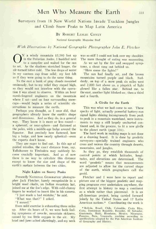
When I wrote the blog about the IAGS I noted that there’s very little available information about the organization on the web and I tried to provide links to as much relevant info as I could find. One of the sources I completely ignored was the excellent article about the IAGS that appeared in the March 1956 edition of the National Geographic Magazine.
Before the National Geographic gave up serious scholarly writing for feel good stories about baby seals and the therapeutic effects of tree hugging it actually published some darned good stories about geography, exploration, and adventure. All three of these elements come together in this great story about the IAGS. It is probably the best, and perhaps the only, popular account of the agency’s activities. So, follow this link and read about the Men Who Measure the Earth.
The Inter-American Geodetic Survey (IAGS) was one of those extremely successful, yet little known, US Army (and later, Dept. of Defense) programs established after WWII.
The IAGS was created specifically to assist Latin American countries in surveying and mapping their vast internal regions that were either poorly mapped or entirely unmapped. The IAGS was established in 1946 as part of the Army Map Service and was headquartered at Fort Clayton in the Panama Canal Zone. The Army Map Service set up a complete survey, cartographic and map reproduction school at Fort Clayton and over the next 30 years trained thousands of military and civilian personnel from most Latin American and Caribbean countries. Attendance at the IAGS school at Fort Clayton was seen as right of passage for many up and coming officers in Latin American militaries, and it was common to run across senior officers – colonels and generals – from South American countries who talked fondly of their time spent at Fort Clayton, taking surveying or cartographic classes (one infamous graduate of the IAGS schools just happens to be Panamanian dictator Manuel Noriega, who attended the cartographic school in the 1960s).
The IAGS didn’t just provide training. It also provided the equipment and personnel to assist the participating countries in establishing their own self-sufficient mapping and surveying programs. The goal was to provide the training, equipment and technical support but have the individual countries take over their own mapping efforts.
Now, I’m not going to pretend that the IAGS was all altruistic good-will on America’s part. We learned the hard way during WWII that many Latin American countries were at best reluctant allies, at worst active sympathizers with the Nazi regime. At the end of WWII the political systems in these countries ranged from shaky democracies to hard line dictatorships. The US Government became concerned about the effects of political unrest and Communist influence in the region, and instituted a number of programs designed to bring Latin America firmly under American influence and to foster democratic principles and improve economic conditions. The IAGS was just one of many programs created as part of this effort. One extremely important benefit the IAGS provided back to the US was that we were able to get American personnel on the ground in these countries to make detailed evaluations of local conditions (after all, that’s what surveyors and cartographers do, right?) and we got maps that were created to US standards for vast areas of Central and South America.
According to all the accounts I’ve read and my own direct experience with the IAGS in Central and South America, the program was a great success. The goals of the IAGS were warmly embraced by most countries, who realized they utterly lacked the resources and training needed to map their own territories. IAGS liasion personnel were permanently assigned to each country, working out of the US embassies, and developed deep and lasting ties with government, military and business leaders. IAGS personnel were very highly regarded in most countries, and I’ve heard more than one old-timer talk about how whenever they flew into a country to work and the local customs agents saw the distinctive IAGS logo on their luggage they were swiftly and courteously passed through customs without inspection or interrogation.
My introduction to the IAGS came when I attended the Defense Mapping School’s Mapping, Charting & Geodesy Officer’s Course at Fort Belvior, Virginia back in 1982. By then the IAGS had been, or was in the process of transforming into, the Defense Mapping Agency International Division (I’m running on memory here, so please forgive any errors). However, the IAGS logo was visible throughout the building, and we received a short orientation brief on IAGS operations. My next contact came in 1990 while working in Honduras as part of an airfield construction task force. My team’s job was to conduct route reconnaissance and terrain evaluation of large sections of southern Honduras. We made contact with the Honduran IAGS liaison officer, Emory Phlegar. Emory was a long time IAGS hand who had ‘gone native’ – he married into Honduran society and seemed to know everyone and everything that was going on in that small, poor country. He provided us a wealth of information and with a simple phone call opened a number of doors for us with the Honduran Instituto Goegrafico Nacional (National Geographic Institute).
Three years later I was stationed at Fort Clayton, Panama, and headed up the geographic analysis team supporting US Army South and US Southern Command. This job put me in close and frequent contact with the last remnant of the IAGS in the old Canal Zone. Southern Command and the Defense Mapping Agency (DMA) ran a joint map warehouse on Albrook Air Force Station. The Air Force took care of ordering, stocking and issuing standard US maps to all US military operating in Central and South America. In the same building the Defense Mapping Agency ran a small but very interesting and critical ‘local products’ warehouse that received and stocked maps printed by the different countries who had been part of the IAGS. By agreement, DMA received 100 copies of every map printed by the participating countries. Quite often these maps were the only representation of Central and South American land areas available to the US military, and we relied heavily on this map supply. In fact my unit acquired an early large format Xerox copier specifically to make copies of these maps for Army use so as not to draw down the limited stock kept by DMA.
Additionally, DMA continued to operate a topographic and survey instrument repair shop out of the building. This was a one man show, employing an instrument repairman who fixed or calibrated any equipment that had been loaned to countries participating in the IAGS. Much of the loaned equipment was simply too big to pack up and send back to Albrook to be worked on, so this lone repairman spent a lot of time on the road traveling from country to country repairing equipment. Most of what he worked on was obsolete by US standards, but was still perfectly serviceable and suitable to the Latin American countries that couldn’t afford anything more modern. As such, his workshop at Albrook was a fascinating mix of spare parts bins and machine tools. Since he dealt with a lot of obsolete equipment I’m sure he had the skills and equipment needed to fabricate any broken or worn part.
Unfortunately there is very little information about the IAGS on the web. Not even Wikipedia has a dedicated page, and only catalogs indirect references to the agency. This is a shame, because the IAGS was a landmark cooperative effort that yielded enormous benefit for all countries involved, and its story needs to be out there for everyone to read. Somebody at the National Geospatial-Intelligence Agency (the successor to the Defense Mapping Agency) or the Corps of Engineers needs to write up a short history of the IAGS and its accomplishments while the participants are still around to tell their stories.
But for now it is You Tube to the rescue! I found this film, part of the Army’s ‘Big Picture’ series, covering IAGS operations: