Origins of the Military Grid Reference System

Several weeks ago John Carnes, owner of the Maptools.com website, contacted me with some additional information regarding the origins of the Military Grid Reference System (MGRS). It appears John has a friend who had some interest in the origins of MGRS and back in 1994 contacted the Defense Mapping Agency looking for information.

John Hager, a geodesist with DMA, responded with a detailed letter and references tracing the history and origins of MGRS. John Carnes has taken this information and created a very informative page on his website. I encourage you all to go to John’s MGRS history page and read up on the history of MGRS and review the links he provides. There’s a lot of great historical information there!

Some points and observations I gleaned from reviewing the documents:

  • The Universal Transverse Mercator Grid system (UTM) was developed far earlier than I thought. Based on my previous reading I thought that UTM had been developed by the Army Map Service specifically to support the development of a world-wide grid reference system like MGRS. However, it appears that the U.S. Army adopted UTM in 1937, years before the creation of the Army Map Service.
  • The original MGRS structure as proposed in 1948 had it covering globe in an area from 80° north latitude to 80° south latitude. Above and below 80° the polar regions were to be covered using the Universal Polar Stereographic (UPS) coordinate system. However, some time after 1948 the MGRS coverage was extended to cover up to 84° north latitude. MGRS was extended into this region as a reflection of NATO’s anticipation of having to fight a ground war with the Soviet Union in arctic regions.
  • There’s a lot of concern expressed by a lot of people in these documents regarding grid zone intersections, or ‘zippers’ as we referred to them. Everyone understood these grid zone intersection areas posed critical challenges and demanded extra caution when directing operations that crossed an intersection boundary. In fact, the issue so concerned the British that they expressed a preference for a less accurate ‘mesh’ grid system that would eliminate grid zone intersections altogether. One of the reasons UTM was selected as the foundation to build MGRS on is because its narrower 6° wide zones introduced less error in these intersection areas.
  • As good as the UTM/MGRS system was (and still is) the fact that it had to be built on ‘local’ datums like NAD27 (in the US), ED50 (in Western Europe) or the Tokyo Datum (in Korea) quickly revealed the need for a world-wide datum, one that was equally good (or as one of my survey instructors put it, “equally poor”) across the globe. This need led directly to the World Geodetic System of 1984, or WGS84, the datum on which all US and NATO military maps are currently based.

So put your geo-geek cap on, head over to John’s website and read up on the origins of MGRS. These documents outline the background of the grid system many of us have a love-hate relation with, yet it’s a grid system that has stood the test of time in places like Europe, Korea, Vietnam, Kuwait, Iraq and Afghanistan, and is now adopted for official use here in the United States as the US National Grid.

– Brian

Longitude

It is rare that a movie or series ends up being as good as the book it was based on; the examples are few and far between. Frankly most films just can’t capture the essence of the story the book’s author worked so hard to get across.  Maybe Gone With The Wind, but that’s about all I can think of right now.

But this weekend I was happily reacquainted with a video series that does a great job of capturing the essence of the book it was based on.  The video series is called Longitude and it’s based on the classic book Longitude written by Dava Sobel.  I consider Ms. Sobel’s book to be a staple of any geographer or topographer’s library and highly recommend it.

Ms. Sobel wrote about the half-century long efforts of a country carpenter and clock maker named John Harrison to claim the prize established by British Parliament that promised to award £20,000 to anyone who develops a practical way of determining longitude at sea. For the British this was a critical issue. The Royal Navy was losing ships and crews at an alarming rate because its sea captains and sailing masters had no way of determining longitude. The British government considered ‘finding the longitude’ to be the most critical scientific problem of its day. Without accurate navigation at sea the British empire may well have died on the vine. After all, if you can’t reliably communicate with your far-flung colonies and safely move people and cargo between the colonies and the British Isles you run the real risk of losing control of your territorial gains.

John Harrison along with his son William built and tested a series of clocks over the span of 40 years, each of which improved on the previous until he reached his final design known as the H4 (for Harrison Number 4), a small, practical chronometer that was accurate enough to permit navigation to within a half degree of longitude, well within the standards set out by Parliament. It is this particular chronometer that became the design model for nearly every mechanical marine chronometer built between 1776 and the development of GPS in the 1980s

What makes the series so good is that it has all the elements required to tell a great story – a good tale, good screenwriters who understand the subject, an excellent cast and good production values. The video series was produced in 2000, five years after Sobel’s book was first published, and the film brings the story to life.  The series was originally broadcast in the US on the A&E Channel, but is now available on DVD. The story is carried by the strong performances of Michael Gambon as John Harrison and Jeremy Irons as Rupert Gould, the shell shocked Royal Navy officer who began restoring Harrison’s chronometers during WWI. The rest of the cast is also first rate and they all seem to have really gotten their teeth into the story and the historical characters they portray.

I do have a few minor quibbles, mainly how 18th Century Royal Navy officers and ship’s masters are portrayed, but overall the video series is excellent.

Here’s a small snippet from YouTube:

Do yourself a favor and either buy or rent this great series. And remember – without the chronometer England might not have had an empire. It was that critical to British history.

– Brian

Christopher Columbus

Word came out earlier this week that marine explorer Barry Clifford has located the shipwreck of the Santa Maria, the vessel Christopher Columbus used as his flagship on his first voyage to the New World in 1492. If Clifford’s claim pans out, this would be the oldest and most historically significant wreck of a European ship in American waters.

The circumstances of the wreck were actually well documented by Columbus in his journal. The Santa Maria apparently died a slow death. Battered and leaky after months at sea with little maintenance, the ship broke her moorings and ran aground on a shallow reef outside Cap Hatien off the north coast of Haiti just after Christmas, 1492.

hispaniola_custom-34e1421a6c894c47ab2433af33a98d08d2af7f83-s40-c85

Excerpt from Columbus’ journal detailing the location of the wreck of the Santa Maria. The general location of the wreck site was always known, but the exact wreck wasn’t identified until 2003

The Santa Maria went down in only 10 feet of water so Columbus ordered the ship to be stripped of her fittings and timbers removed for use on land. All that remains today is the ship’s ballast field and perhaps some fittings that weren’t salvaged. The wreck was apparently identified by the remains of a wooden cannon mount, a type that would have been unique to the Santa Maria.

santa_maria_vray24

A modern recreation of Columbus’ Santa Maria

This discovery causes me to think again about Columbus’ place in the pantheon of explorers and navigators. Columbus’ reputation has suffered mightily in the last 50 years or so. He’s gone from a revered European explorer with his own national holiday and dozens of American towns and cities named after him to the despised symbol of all that was bad about European colonization and exploitation of the New World.

Revisionist history can be a dangerous practice, and I believe Columbus has been treated badly by those who blame him for everything from smallpox to global warming. Columbus was very much a man of his time – he was no more exploitative, cruel or greedy than any other late-15th century explorer and navigator. One thing we know for sure, if Columbus didn’t set sail for the ‘Indies’ in 1492 another European explorer would have tried it soon after. European merchants were being squeezed out of the extremely lucrative trade with the Far East empires by pirates, local warlords and caliphs who controlled the sea lanes and trading ports between eastern Africa and the Far East.

Columbus’ sales pitch to King Ferdinand and Queen Isabella made perfect sense; the world is round (everybody in the 15th century who could read understood that) and the latitudes of the key trading ports in the Far East were well known. All one has to do is sail straight west from Spain along a known latitude and eventually you’ll run smack into the the trading ports in the West Indies. None of that messy sailing around the Horn of Africa business or fighting off pirates or paying off local warlords. It was an enticing argument – sail west, hit the trading ports in the Indies, load up with highly profitable trade goods and sail back east to the home country to unload, sell and enjoy immense profits. I have no doubt that in 1492 other European explorers and traders were thinking the exact same thing. It was simply the next logical step in establishing trade routes in search of new markets. If not Columbus another European with the same outlook and values would have made the voyage, made landfall in the New World and set in motion the exact same chain of events that led us to where we are today. It was a historic inevitability. Let’s stop blaming Columbus.

We know very little about Christoper Columbus’ early life, and it appears that’s the way he wanted it. He was born in Genoa in 1451 to a family that engaged in a broad variety of commercial endeavors. He went to sea early in life, starting as a deck hand on the small sailing ships that moved trade goods between the major Mediterranean ports. But Columbus was smart and fairly well educated for his time. He was also a keen observer and a quick study. At one point he got into the map making business, which put him in touch with most of the experienced explorers and navigators of his time. He also participated in longer and longer sea voyages as the Portuguese and other European traders probed further and further south and west into the Atlantic, discovering the scattered island chains like the Azores, the Madeiras and the Canary Islands.  Along the way Columbus became an expert navigator. Perhaps just as important, his extended sea voyages west into the Atlantic convinced him that existing sailing and navigation technology could make long ocean voyages westward to the Indies not just possible, but practical. Unlike so many sailors of his day Columbus was not afraid to sail well out of sight of land. He was a confident and competent navigator, one of the best of his time.

800px-ColombusMap

A map (more commonly known as a ‘portolan chart’) published by Christopher Columbus and his brother Bartolomeo in their Lisbon workshop, 1490

Columbus was also a businessman and a bit of a hustler. He knew he needed financial backing for his plan and he spent years peddling his idea around the courts of Europe. Monarchs of his day weren’t dumb. Those that had any interest in his scheme turned the proposal over to the more learned men of their court for review and recommendation. In virtually every case Columbus was turned down not because his idea was bad (many court scholars agreed the general idea had merit), but because Columbus badly under estimated the circumference of the earth. In his proposals Columbus stated the circumference of the earth was several thousand miles smaller than it actually is. The problem for Columbus was that in the 15th century the general circumference of the earth was well know. In fact, it was first accurately measured by the Greek mathematician Eratosthenes about 190 B.C. All the smart guys in Europe knew this. Everyone except Columbus, it seems. Or was his ignorance really a marketing ploy? Columbus knew he had to sell his idea as a practical, repeatable way to make money. By understating the sailing distance from European ports to the West Indies he was implying reduced risk, lower operating costs and greater profits.

Like the monarchs Columbus pitched his idea to, he wasn’t dumb. I’m betting he clearly understood just how big the Earth is. My guess is that based on his experience sailing to the island chains off the west coast of Europe and Africa he was expecting to find mid-ocean islands he could use to rest and refit as necessary. But this is just my speculation. We’ll probably never know Columbus’ true thoughts or motivations.

Of course we all know that Columbus eventually found his patrons, got his ships and crews, sailed west and inevitably bumped into the ‘Indies’. The rest, as they say, is history – our history.

Christoper Columbus deserves better press than he gets today. The European discovery and settlement of the New World was inevitable. If not Columbus then someone else very soon after 1492. So let’s celebrate Columbus the explorer, map maker and master navigator.

– Brian

From The Deck Of The SS Northing & Easting

Earlier this morning I let the dogs out to do their business and stepped out onto my deck to have a look around.  Although it was a bit cloudy out I noticed that the Moon was hanging brightly about 8 degrees above my roof line.  Dawn was just starting to break and I figured it would be a good time for this pseudo-mariner to get some practice sights in with the sextant.  The moon is entering its last quarter here in Georgia and there was still enough of the orb available for a good upper or lower limb shot.

I grabbed my old Astra IIIB sextant, screwed on the artificial bubble horizon and spent about 10 minutes practicing ‘pulling down the sight’, focusing more on technique than accuracy.  With a bubble horizon you have a lot of room for error because the horizon indicator (the bubble) is so large when viewed through the sight tube.  Don’t worry – around 0720 EST the Moon was hanging at about 40 degrees 4.8 minutes, right where it should be.  The clockwork heavens are still ticking along just fine.

Astra IIIB Sextant

As I was fiddling with the sextant the winds started pushing the low clouds around and the Moon began darting in and out of view, sometimes partially obscured, sometimes fully obscured.  This made for an interesting practice session as I was forced to time the approach and departure of the heavier cloud patches and practice pulling down the sight quickly before the Moon became too indistinct for a good shot.   This is a common problem in celestial navigation – the navigator is at the mercy of the weather.  That’s why so much emphasis was placed on grabbing a celestial shot whenever the heavens and the weather cooperated.  It is also why so much emphasis was placed on accurate dead reckoning – estimating your current location based on distance and direction traveled from your last known location.  Since you were never sure when you’d be able to get your next celestial fix an accurate running estimate of your position was absolutely crucial.

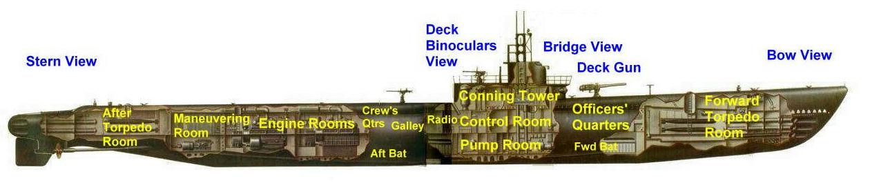
I was reminded of the particular problem celestial navigation posed for our submarine crews in WWII.  More than any other arm of the Navy, the Submarine Service operated far into enemy waters in search of victims, and they traveled alone.  Accurate navigation was absolutely essential and the navigators assigned to our submarines were some of the best the Navy produced.

WWII submarines were extremely vulnerable when caught in the wrong combination of circumstances.  Our subs like the Gato-class boats were really highly modified surface ships that could spend limited amounts of time under water on battery power.

US Gato-class submarine

The lower spaces of these subs were filled with giant lead acid batteries that allowed the boat to remain submerged for up to 48 hours and maneuver slowly (9 knots).  Eventually, however, the sub had to surface to charge her batteries, refill her air tanks and get a navigational fix.  For a boat operating alone in enemy waters this was a hazardous activity.  A submarine was never more vulnerable than when on the surface with low batteries.  It was common practice for the subs to surface in the dark of night and make a high speed dash to a new hunting area while replenishing her batteries.  The problem is that the middle of the night is generally a lousy time for a celestial fix.  Sure, the skies are filled with stars and planets, but the horizon is difficult to distinguish.  The best time for a fix is at nautical twilight, when the sun is 6 – 12 degrees below the horizon.  At this time the nautical horizon is still distinct and key navigational stars and planets are visible in the darkening sky.  But there’s also enough light left to be spotted by an enemy aircraft or nearby surface ship.

This led to a unique ‘navigator’s dance’ on American submarines.  At twilight the Captain would bring the boat to periscope depth to check for enemy ships and aircraft and to check weather conditions.  If the skies were clear of enemy and clouds he’d give the heads up to the navigator, who was usually the boat’s executive officer.  The navigator would have already checked his navigational tables and picked one or more likely celestial objects to try to use for a fix.  This could be a planet or bright star or, if he was really lucky the Moon was already up and far enough above the horizon to provide a good fix.  The navigator would often wear goggles with red lenses to get his eyes adapted to dark conditions.

The Captain would give the command to surface the boat and once the conning tower was clear of the water the hatch would be opened and the watch personnel would scramble up with binoculars, climb the periscope shears and scan the skies and the horizon for any signs of the enemy.  Once the all-clear was given the navigator would come up with the sextant hanging from his neck by a lanyard.  He would take a series of quick shots on the available celestial bodies and call the sextant readings down to the navigation team in the control room.  The navigation team would note the time of the observations against the boat’s chronometers and begin the process of using the sight readings to establish a line of position.  A quick shot on Polaris gave the navigator an accurate and easily determined latitude, but the shots on the stars and planets to determine longitude took a bit more number crunching.  Things like the height of the navigator above the surface of the water, the time difference from GMT, the uncorrected error built into the sextant and other factors all had to be calculated.  This process was called ‘sight reduction’.  It was (and still is) straight forward but somewhat tedious math.

In the end the navigation team (usually consisting of the executive officer, an enlisted navigator known as a quartermaster and another pair of trained eyes, often those of the Captain) would come up with intersecting lines of position, one for latitude and one for longitude, that provided the boat’s true position at the time the sights were taken.

Here’s an interesting description of the process taken from the book The Underwater War 1939 – 1945 by Richard Compton-Hall:

Away from land every opportunity for taking sun, moon, planet and star sights had to be snatched. Sight-taking with a sextant was treated as an evolution; if surfacing primarily for that purpose it was combined when possible with ditching (trash) — which made matters no easier for the navigator competing in the conning tower and on the crowded bridge with a hustling (trash) party, the lookouts and the sea itself. The smallest drop of water on the sextant mirror made sight-taking impossible and the instrument had to be wrapped tenderly in a towel when not actually bringing the observed body down on to the lurching, irregular horizon which, with so low a height-of-eye, made the task doubly difficult. The ‘exec’ was primarily responsible for navigation in American boats (assisted by excellent quartermasters) but German commanders relied upon the equivalent of a specially trained warrant officer to take sights. Most British captains thought sight-taking far too important to entrust to Vasco (the navigator) and did the sextant work themselves; but they were quite happy to delegate the long and boring working-out of the sights when they were taken! It could easily take an hour to plod through the spherical trigonometry (which actually amounted to no more than straight forward arithmetic) before arriving at a solution which almost invariably produced a large cocked hat; this led to thinly veiled hints from Vasco to the effect that the captain was incapable of reading sextant angles, and to more direct accusations from the captain that the navigator was incapable of simple addition and subtraction. Some boats carried rapid reduction tables derived from air navigation manuals which greatly shortened the time required to produce a fix: but the Royal Navy and most other services clung doggedly to Inman’s Nautical Tables with their long columns of five-figure logarithms.

Today we are spoiled.  Want to know where you are on the face of the earth to within a few hundred feet?  Just turn on your smartphone or GPS receiver.  Within seconds you’ll get a position fix that is far more accurate than any experienced navigator could have calculated using celestial navigation.

Yet I believe it is important we continue to practice the old techniques.  First, it is great mental exercise.  To be a good celestial navigator you need to be at least proficient in basic astronomy and mathematics.  You need to know how to evaluate and calculate error.  You need to be a good problem solver.  Celestial navigation is like golf – it takes just a few months to learn but a lifetime to master.  It sure beats playing another round of World of Warcraft.

Next, celestial navigation gives one a greater appreciation for the technology we have available today, and that appreciation and the resulting awareness of the GPS system’s capabilities and limitations will make you a better navigator overall.

And last, the celestial navigation techniques and tools we use today are exactly the same as those used by history’s great explorers and navigators – Capt. James Cook, Lewis and Clark, Robert Peary, Roald Amundsen, Earnest Shackleton, Robert Scott, Capt. William Bligh (yes that Capt. Bligh) and many others. Anyone interested in the history of exploration can make a direct and relevant connection to their heroes and better appreciate their achievements by dabbling in celestial navigation.

So that’s today’s report from the deck of the SS Northing & Easting.  I’ll keep the spyglass and blunderbuss handy in case the pirates try to board.

Brian