An Army field manual as a book of the month? Just how interesting or relevant or important can a field manual be?
Well follow along, because for certain groups of people this FM is very interesting, relevant and important.
FM 21-26, Map Reading and Land Navigation is the Army’s map reading and land navigation handbook. This manual has been in continuous publication and upgrade since 1941. The current edition is dated 2005, with changes posted in 2006. As part of a sweeping Army field manual re-designation the manual has been renamed FM 3-25.26*. Regardless, it is still commonly referred to as FM 21-26, and that’s how we’ll refer to it here.
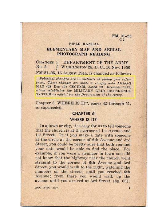
The Army seems to have adopted standard map reading and land navigation practices back in 1939, and published its first series of map reading and land navigation manuals in early 1941 (FM 21-25, Elementary Map and Aerial Photograph Reading and FM 21-26, Advanced Map and Aerial Photograph Reading). Prior to 1939 map reading and land navigation was viewed almost as a black art, covered in non-standard texts targeted at officers and emphasizing field sketching and rudimentary survey as much as map reading and navigation. A large part of the problem was that the Army had no map standards or centralized map production, so providing maps for unit operations was a local commander’s headache. If you were a regimental commander and wanted a map of an area you put your regimental engineers to work either finding suitable maps from local or commercial sources, or you had them drawn up from field sketches or plane table surveys.
Army leaders realized that in the looming global war the old ways of producing and using maps would not do. The Army needed dedicated map production assets that could produce millions of maps using common symbols, colors and scales. This led to the creation of the Army Map Service and the standardization of map production on a global scale. Once you had map standards in-place and maps in production you could develop standardized map reading and land navigation practices using these new maps. FMs 21-25 and 26 were the result of that effort. Finally, the Army had standardized map reading and land navigation texts it could use to train the millions of Soldiers about to be drafted into the Army to fight WWII.
After WWII, the establishment of NATO and the US Army’s realization that it would still maintain global warfighting responsibility the two field manuals were combined into one – FM 21-26, Map Reading, published in 1956. The significant change in this manual was the introduction of the Military Grid Reference System (MGRS) based on the Universal Transverse Mercator (UTM) coordinate system. The development of UTM and MGRS signified a revolution in mapping and mapping grids. For the first time an army had an accurate low distortion world-wide grid system suitable for large scale mapping. With MGRS and using just a paper map and a simple protractor a Soldier could uniquely identify his position anywhere on the face of the earth to within 10 meters. MGRS is accurate, easy to teach, easy to use and virtually ‘soldier-proof’.
Updates to FM 21-26 came out every few years and the major changes seem to have been the simplification of basic principles and techniques, and the dropping of out-of-date or no longer needed procedures (like interpreting hatching to indicate landforms or the use of obsolete equipment).
Today’s FM 21-26 is map reading and land navigation distilled down to the basic, easy to learn and easy to execute functions. It is not just map reading, but it is also the use of map substitutes (mainly aerial and satellite images), dead reckoning, field expedient direction finding, basic orienteering, terrain association and basic field sketching. One key item of note is the Army’s method of teaching how to determine the magnetic to grid declination factors. The lesser or greater angle method is hands down the easiest way to manage this often confusing issue.
Sure, FM 21-26 has a military focus. It is, after all, an Army field manual. The book spends a lot of time discussing the use of the MGRS system, how to orient, plan and navigate using MGRS. It’s MGRS, MGRS, MGRS. For years civilian students of map reading and land navigation had no use for this portion of the manual. Topographic maps of the US either had no grids or had grids different than the MGRS grid, and US-based maps were printed at scales different than those used by the military. This has all changed. In just the past few years the US has (finally!) adopted what is known as the US National Grid. The US National Grid is now being implemented for all USGS (US Geological Survey) large scale (1:24,000 and 1:100,000) topographic line maps, and the USGS is rushing the new US Topo series of maps into production. So what is this new US National Grid? It is nothing more than MGRS implemented for all USGS topgraphic maps of the US. Remember, MGRS has always covered the world, but the US military does not produce maps of the US – that’s the job of the USGS. The MGRS grid template always existed for the US, but the USGS never adopted it. Until 2008, that is. Driven by homeland security and disaster relief coordination concerns the USGS formally adopted MGRS, known as the US National Grid in the US, and is now producing maps to that standard.
Suddenly the discussion of MGRS in FM 21-26 becomes very relevant. All the MGRS-based map reading techniques can now be directly applied (and are intended to be applied) to the new USGS topographic maps. The only remaining issue is that of scale. The US military produces large scale maps at 1:50,000 while the USGS produces large scale maps at 1:24,000. While all the MGRS techniques apply to USGS maps, you can not use the standard map protractor (GTA 5-2-10) discussed in FM 21-26 since it does not have a 1:24,000 plotting scale included. This isn’t a real problem because a number of manufacturers offer MGRS/US National Grid plotting scales for use with 1:24,000 scale maps. One of my favorites is the Super GTA tool produced by Maptools.com.
Another great thing about FM 21-26 is that it is one of the few Army field manuals authorized for unlimited release. This means the Army retains the copyright to the manual, but users are free to copy, reprint and distribute it without penalty. As a result you can find free downloads of FM 21-26 all over the web and you can purchase inexpensive printed copies from retailers like Amazon.com.
So, if you like maps, are interested in map reading and land navigation, or have just a passing interest in these topics go get yourself a copy of FM 21-26!
– Brian
*The new designation of FM 3-25.26 seems a little unusual in the overall scheme of revised manual numbering. I’d like to think that someone in TRADOC with a respect for military history recognized the significance of the original series of manuals, FM 21-25 and FM 21-26, and as a nod to tradition decided to redesignate the new manual as FM 3-25.26.