
Time for some polite applause.
Yesterday ESRI released an update to ArcGIS Online. This is a significant update because it adds a number of enhancements that the user community has been requesting for quite some time.
The first enhancement we’ll talk about is labeling. Labeling of hosted feature services has to be the #1 update requested by (paying) customers since ArcGIS Online launched in 2012. A hosted feature service is a type of map service that is stored (or hosted) in ESRI’s ArcGIS Online cloud. Before yesterday the only way to get labels into your ArcGIS Online web maps was to stage your data as a dynamic map service on your own internal servers running ArcGIS for Server or create a cached map (tiled) map service. Both of these options are expensive in cost and overhead. With yesterday’s update you can generate labeling against hosted feature services from within the web map interface.
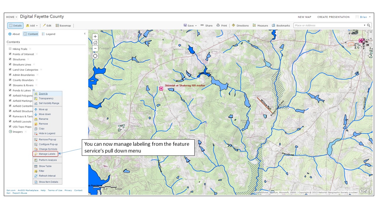
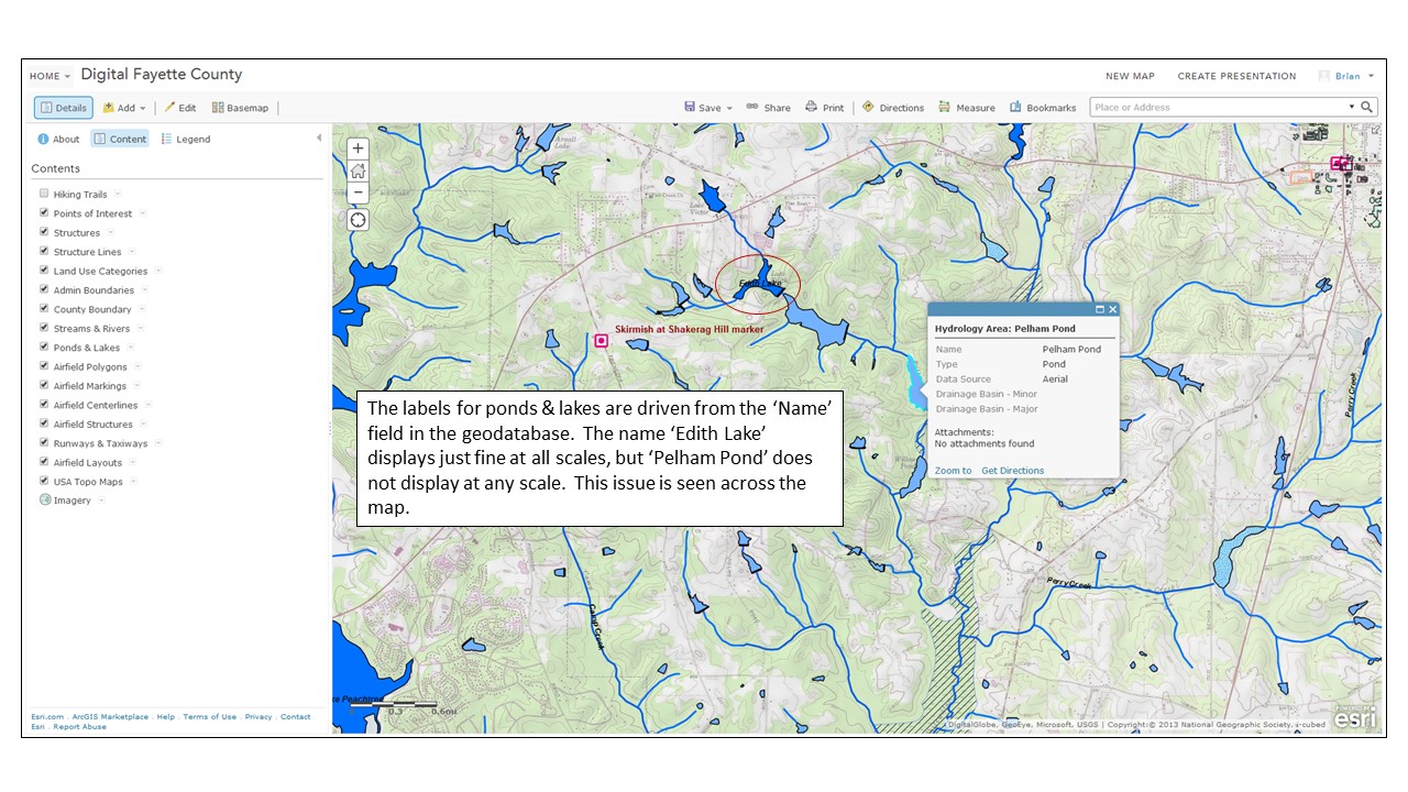
The labeling options are fairly limited. The user gets to choose label placement (above, below or on the line.), which geodatabase field(s) will drive the label name and some basic text formatting options. The line/polyline labeling works well, but there appears to be some major issues with polyogn labels not displaying, even in areas where there are no competing labeling issues.
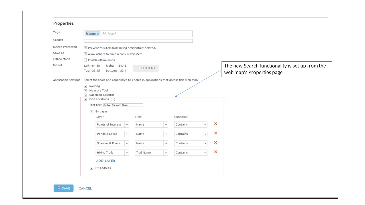
Another critical update is a new search function. ESRI has offered filtering against map layers for some time, and that’s a type of search, but that functionality is intended mainly to generate new focused map layers. For this new search functionality ESRI decided to embed the feature in the web map interface rather than access it from a specific map layer. At first I was a bit confused as to what ESRI was trying to achieve with this new feature – I expected any new search function to be driven from the map interface. However, once I played with it I see ESRI’s logic, and I like how they implemented it.
The search criteria is first set up on the web map’s Properties page.
Once the search criteria are set up on the Properties page the user can access the functionality from the web map’s search window.
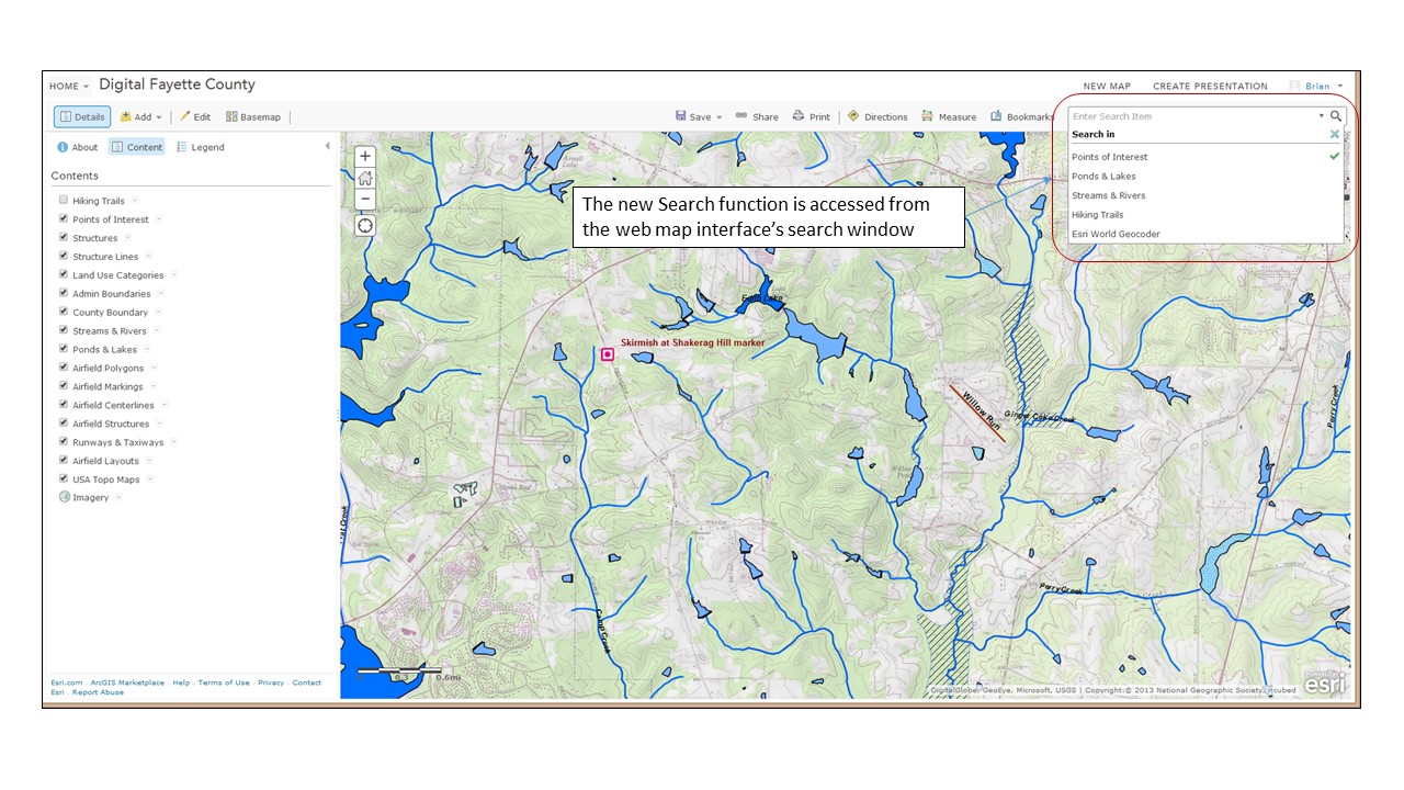
The Search function will zoom to the selected feature and activate associated pop-ups.
 While this is a very simple search functionality it works well and I like how it was implemented.
There are a host of other key updates. I won’t go into detail on them, but new features that have caught my eye include:
- The ability to display related data in web map pop-ups
- An update to the Basic Viewer map template that supports searches. The Basic Viewer is one we use heavily in our organization and I’m glad to see this one get a key update
- The new GeoForm template that allows users to add data to a web map via a web form instead of though a pop-up
- When exporting data from a web map in file geodatabase format all attachments (pictures, documents, etc.) get exported along with the data
This is just a first and fast look at the new features. There’s a lot of good stuff in here and it’ll take me some time to play with it all. In a few weeks I’ll be out at the annual ESRI International User Conference and I’m sure these new features will get a lot of coverage during the Plenary sessions. Something to look forward to!
– Brian
