
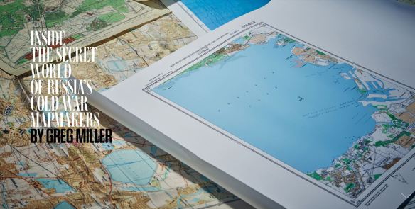
Yesterday the folks over at Wired posted a really neat article on the Soviet Union’s military mapping program during the Cold War titled Inside the Secret World of Russia’s Cold War Mapmakers.
The author seems to imply that the Russians were better at this sort of thing than the US was. Oh pish-posh. I spent most of my 23 year career in the US Army doing this very same thing – compiling what we called terrain intelligence (now called geospatial intelligence) and placing it onto annotated maps or, more commonly, map overlays. This was GIS long before there was GIS.
But while the former Soviets have done a wholesale dump of their formerly classified terrain intelligence data onto the commercial market to make a few bucks, the US and NATO studies are likely still classified and remain under lock and key.
The Soviets and the US (and our NATO partners like the British and Germans) approached the task in the same way – use every available source, from readily available tourist maps to ‘technical intelligence’ (aka, spy satellites) and on-the-ground observers (aka, spies) to compile extremely detailed map-based studies. In my field we tended to concentrate on factors that would directly impact Army ground operations, things like soil conditions, vegetation types, ground slope, road and bridge capacities, building densities in cities and towns, airport and landing zone data, river and stream conditions and much more.
What made the Soviet’s job so much easier is that the West’s open societies gave them virtually unrestricted access to accurate, detailed mapping data compiled for civilian use. A Soviet military attache assigned to their embassy in Washington DC could simply walk out of his embassy compound and stroll a few blocks to one of several well stocked map stores in the US capital. This included, I’m sure, the excellent map holdings over at the National Geographic Society. The US Geological Survey’s map store was just a short drive away in Reston, VA and I’m sure the Soviet Embassy was one of its best customers.
This military attache’s counterpart in the US Embassy in Moscow couldn’t do the same thing. The Soviets simply didn’t sell or give away maps of their territory. Most mapping data, even the most innocuous, was considered classified. That meant we had to get the data some other way. Of course I’m sure we did our share of bribing, cajoling, blackmailing and stealing to get copies of their maps (remember now, this was a cold war; we weren’t playing patty-cake), but we also very quickly developed out ‘technical intelligence’ capabilities – again, spy satellites – that allowed us to accurately map vast areas of the Soviet Union and her client states from space. It is said that the Defense Mapping Agency was the single biggest consumer of spy satellite imagery during the Cold War.
So dear reader, rest assured that while the Soviets were spying on us to develop highly accurate map and geographic intelligence data we were doing the exact same thing to them. We just haven’t seen the need to sell our intelligence on the open market to make a fast buck.
– Brian
