The Littlest Geo-Geek

So I came home from work yesterday, sat down at my computer and was surprised to find this:

ArcCatalog

No less than eight instances of ArcCatalog running. Huh? When I left for work in the morning the only thing open on the computer was Chrome. Did some eeeevil ESRI trojan take control of my desktop?!

Then I remembered – this little two year old cutie spent the day with Grandma:

Helen

And this cute little tornado takes every opportunity to search every computer, tablet or iPhone she gets her hands on for this:

FROZN_014M_G_ENG-GB_70x100.indd

I applaud her early interest in investigating the mysteries of the geosciences and exploring ESRI’s software offerings. It warms the heart of this old geo-geek grandfather.

…or could it be she just made a series of random mouse clicks while singing (for about the 20th time that morning, according to Grandma) “Let it go, let it goooooo”?

Grandpa prefers to think she’s a budding geo-genius.

– Brian

It’s Throwback Thursday!

Everybody does ‘throwback Thursday’ these days, so why not me.

I came across these quirky but interesting (for a topo geek and an airplane geek) video clips on YouTube and thought I’d share them.

First, a nod to our Air Force friends. From WWII right on through the 1980s the Army Topographic services relied on the US Air Force for wide-area mapping photography support. The Army did pick up some missions using its fixed-wing intel platforms like the venerable Grumman OV-1 Mohawk, but for the most part it was the Air Force (or the Air Force Reserves or Air National Guard) who handled the military requirements for mapping photography. You can read more about the USAF’s photomapping activities at the 1370th Photomapping Squadron’s history site. In fact, as late as 1994 in Panama we were tasking the Air Force to fly Furbish Breeze photo reconnaissance missions over key areas of Ecuador and Peru for cartographic map updates and terrain study development. Furbish Breeze wasn’t a mapping camera system, but it was the best we had available at the time and the Air Force was happy to fly for us.

Let’s start with 1961 and British Guiana. This looks like a home movie shot without sound and it depicts the mundane routine of supporting photomapping missions in British Guiana (today’s Belize). I’m guessing this mission was being run in support of the IAGS. This is the 1370th Squadron in action:

Next, let’s move to Vietnam. Here’s a video showing 1370th operations out of Tuy Hoa Airbase in South Vietnam in 1968. The Army Topographic services had a huge mapping mission in Vietnam – most of the original mapping of the country had been done by the French pre-WWII and was badly outdated by the time US forces got heavily involved in the conflict. Army Topographic units had to re-map the entire country at all scales, and had to do it fast. We relied very heavily on mapping photography provided by the 1370th:

Honestly I have little or no idea what these guys are doing inside the aircraft during flight. I get the general idea that they are checking in with HIRAN ground stations and monitoring camera operations, but that’s about it. If there are any USAF photomapping veterans out there who’d like to provide some insight into what’s going on in the videos please chime in!

Next, it’s something for the Squids (sorry, I couldn’t resist). These videos don’t depict mapping or charting activities, but they are interesting snapshots of photo intelligence activities.

The first video is a short clip showing what I assume is a photo interpretation team aboard an aircraft carrier reviewing stereo photos during WWII:

Next is a formally produced video made during WWII showing the importance of aerial photo reconnaissance in the Pacific Theater. Beyond the ‘mom & pop homefront’ scenes at the beginning and end of the video it’s actually pretty good. And hang in to the end to see Navy Commander R.S. Quackenbush discussing the importance of photo reconnaissance and take note of the stereoscopes and aerial photography neatly arrayed on his desk for dramatic emphasis:

Thanks for watching!

– Brian

The Frost Course

…or how I learned to live on coffee and Tylenol for two weeks.

In the military there are certain rights of passage, like your graduation parade at the end of basic training, or making your fifth parachute jump and getting your silver parachutist wings, or getting your butt chewed by the First Sergeant for showing up late for formation, or going down to Yadkin Road and getting your first tattoo (you old Fort Bragg veterans will know what I’m talking about).

In my old field, terrain analysis, one of the rights of passage was successfully completing the Frost Course. No, the Frost Course didn’t have anything to do with the weather, and it wasn’t a poetry reading class. The Frost Course was considered a master class in the use of stereo aerial photography for landform analysis and military terrain analysis.

The course was developed by Dr. Robert E. Frost while working for the US Army’s Engineer Topographic Laboratories (ETL) where he headed up ETL’s Center for Remote Sensing.

130222-A-CE999-015

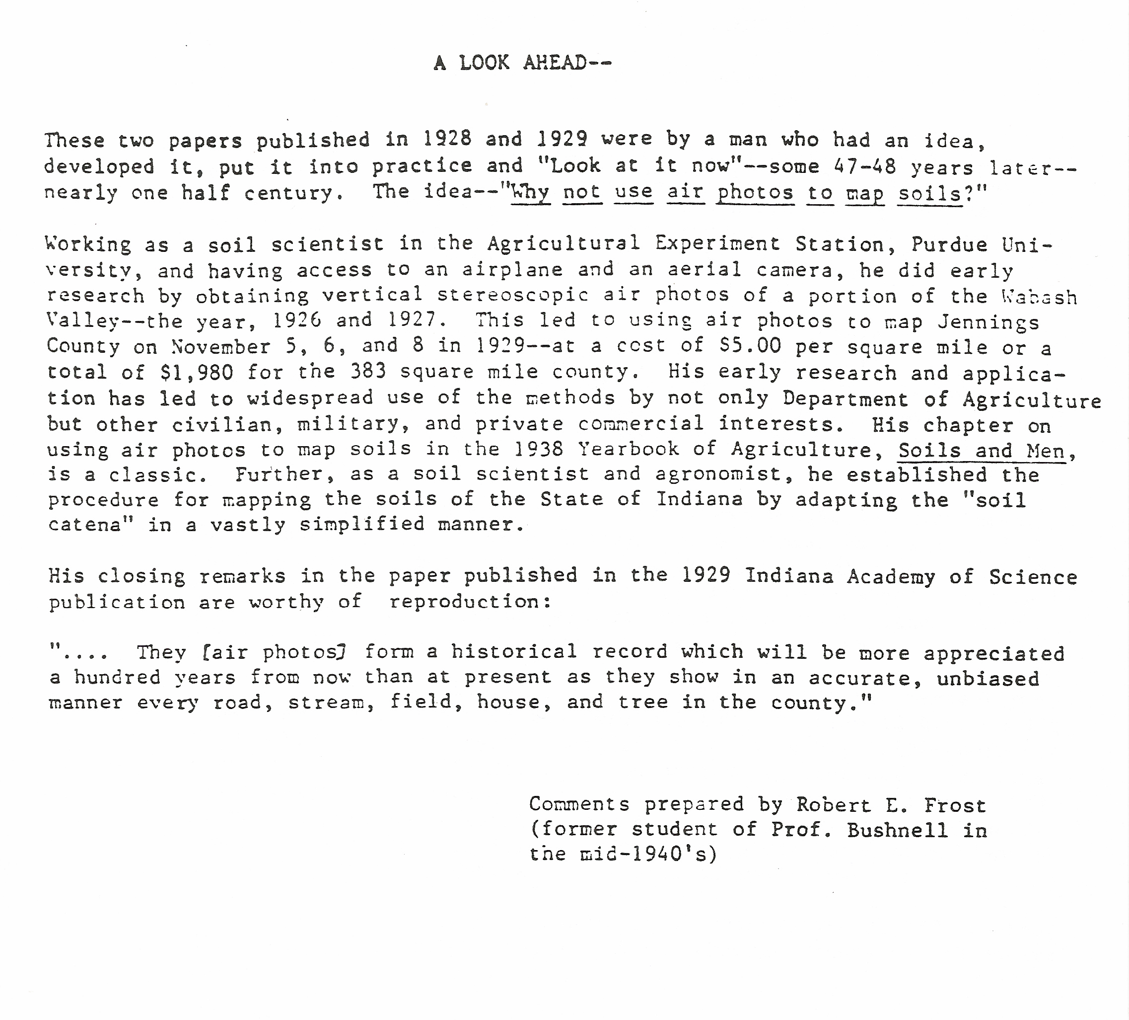
As I once heard Dr. Frost explain it, the analyitical techniques taught in the course were developed over several decades of research based on aerial photo analysis in support of a wide variety of military and civil projects for the Army Corps of Engineers. His work dated all the way back to WWII and Purdue University, where he pioneered many of the aerial photo pattern analysis and terrain analysis techniques that would become the backbone of later Army terrain analysis training.

Scan.BMP

Dr. Frost began his career at Purdue University, where pioneering research in the use of aerial photography for terrain and resources analysis began in the late 1920’s.  Frost worked at Purdue with both Professor Bushnell and another aerial photo analysis pioneer, Dr. Donald Belcher before moving over to the Army Corps of Engineers


L1/Korean War 1950-1953/pho 28

During WWII the Army Corps of Engineers vastly expanded the use of aerial photography for mapping and terrain analysis. This demand was triggered by pioneering work done in the 1935 – 1941 time period by both Army topographic engineers and researchers at places like Purdue University who developed the aerial camera systems and analytical processes and tools needed to exploit this new resource


Dr. Frost noted that he expanded this work into historical terrain analysis while acting as an expert witness in a string of court cases brought against the Corps of Engineers. Starting in the 1970’s the Corps of Engineers became a favorite target of the environmental movement. The Corps was an easy mark. It was involved in billions of dollars of public works projects across the United States, most involving waterways improvements. In mid-20th century parlance ‘improvements’ mean draining wetlands, building dams and levees, dredging rivers and digging canals. A favorite joke of the day went like this: “Why don’t Corps of Engineer officers help their wives with the dinner dishes? Because they can’t stand the sight of running water!”

At some point the Corps of Engineers turned to Dr. Frost to see if he could develop evidence to prove that Corps projects were not responsible for the impacts the plaintiffs were seeking damages for. Dr. Frost figured the best way to approach the problem was to look at the history of the project areas as shown in successive years of aerial photography and try to determine the what was causing the issues the land owners and environmentalists were so upset about. Dr. Frost and his team at the Center for Remote Sensing went through the vast aerial photo archives of the the USGS, NOAA, the Soil Conservation Service, the Department of Agriculture, the Tennessee Valley Authority, state and local agencies, private aerial survey companies and even the Corps of Engineers’ own holdings to build a library of historical aerial photography covering various Corps’ project areas. Much of this photography went back into the 1930’s and predated by decades the projects that were in dispute.

Dr. Frost’s team then applied the aerial photo analysis techniques developed over decades of research and field study to establish a terrain analysis ‘timeline’ of the changes that took place over the project areas. More often than not Dr. Frost and his team were able to prove that the Corps of Engineers’ activities were not the proximate cause of the issue. Things like historical land use changes, flood and drought cycles, poor erosion control, poor land management practices or other human or environmental impacts that had nothing to do with the Corps’ activities were frequently identified as the root cause of the problem.

photo_lantz

OK, who’s gonna’ pay?


In the late 1970’s the Army recognized the growing demand for terrain analysis products needed to support military planning and operations. The decision was made to establish Engineer terrain analysis teams at the division, corps and echelons above corps levels. The analysis processes the Soldiers in these units used were based on techniques developed by ETL’s Terrain Analysis Center. Dr. Frost and the Center for Remote Sensing were key resources the Terrain Analysis Center turned to for help developing the aerial photo analysis techniques that needed to be taught to the hundreds of enlisted analysts and warrant officer candidates that would make up these new terrain analysis teams.

zts

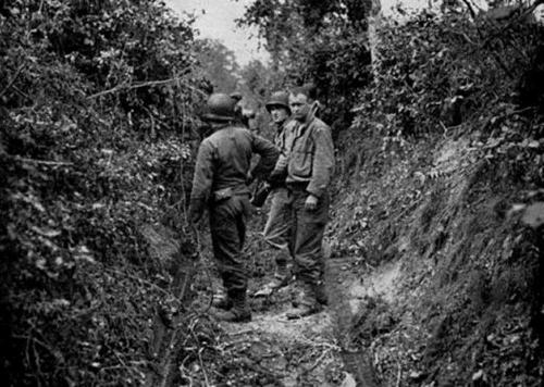
Germany 1985. Soldiers of the 517th Engineer Detachment (Terrain Analysis) use a zoom transfer scope (ZTS) to create terrain overlays using aerial photography. The study was done to support the V Corps REFORGER 85 exercise. The overlay will depict soil types that are least able to support off-road vehicle traffic. The techniques used to analyze the imagery were developed by Dr. Frost and his team at the ETL Center for Remote Sensing and the ETL Terrain Analysis Center. CW2 Tim Butler, the detachment’s terrain analysis technician and an early graduate of the Frost Course, is at the ZTS

Reforger85CCM

The resulting analysis for REFORGER 85 was used daily to predict areas at high risk for maneuver damage based on soil type, moisture content and ground temperature.  After the exercise V Corps announced that this analysis saved an estimated $1 million dollars in maneuver damage claims compared to previous REFORGERs


At some point Dr. Frost decided to package his experience and analysis techniques as a formal class, and the Frost Course was born. This course took the elementary photo analysis processes taught in the terrain analysis classes at the Defense Mapping School and expanded them to cover a wide range of topics beyond military applications, adding course content in geology, soils science, forestry, agriculture, hydrology, transportation and urban analysis. Woven into the course were college-level requirements in analysis, research and thesis defense.  It was a master class in aerial photo analysis for topographic and terrain analysis.

Scan-001.BMP

Dr. Frost’s ‘Statement of Principles’ for the Frost Course

Starting in the early 1980s Dr. Frost taught his class regularly at the Defense Mapping School (DMS) at Fort Belvoir, VA. Unlike so much US Army military training at the time the Frost Course was actually challenging; Dr. Frost forced you to analyze and think. There were no multiple choice questions in his course. You discussed a particular terrain issue, reviewed applicable analytical techniques, were presented with a problem, sent off to do the analysis and then came back to present your results and defend your conclusions. While you couldn’t actually fail the Frost Course, the competition to get into the class was so tough that only highly motivated Soldiers attended, so the quality of the output – skilled terrain and topographic analysts – was quite high.

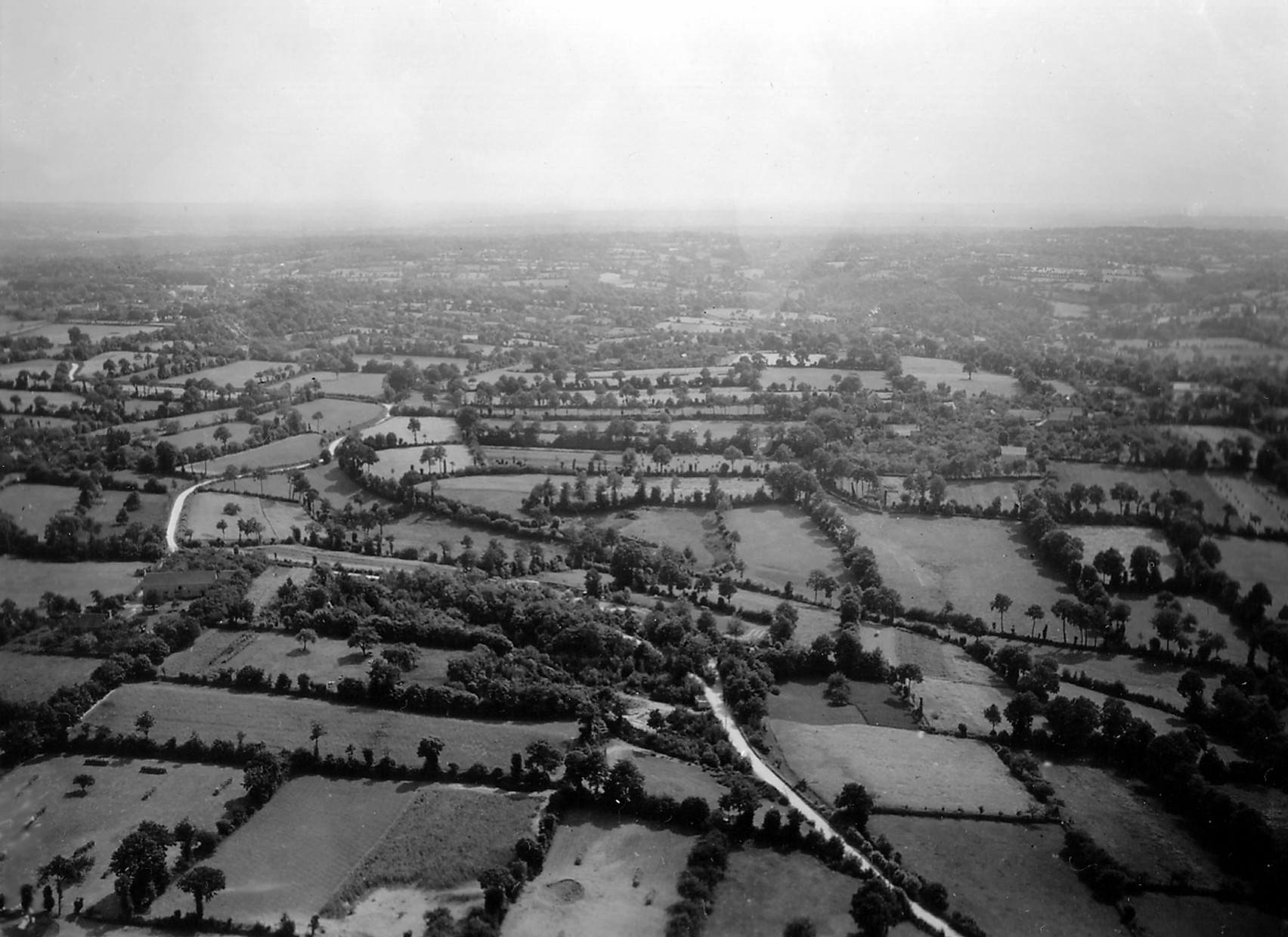
The Frost Course was taught in modules (called ‘Problems’), with each module teaching a particular analytical process based on things like landform, pattern, hydrological, transportation or urban analysis. Each module consisted of some instructional material, references, an assignment sheet and a set of stereo aerial photos.

Frost Course Module 3

Frost Course Problem 3, Pattern Recognition


Frost Course Module 3 blow-up

Problem 3 required detailed analysis of a stereo triplet to determine the landforms, drainage, vegetation, cultural and land use patterns. These are current photos taken of the coursework I completed in 1995.

The joke was that when you showed up for the Frost Course you got issued two things – a pocket stereoscope and large bottle of Tylenol. That’s because you spent 6 hours each day in class staring at stereo photos and then you went home and spent another couple of hours peering through the stereoscope as you worked on your homework assignment. Headaches due to eye strain were the norm.

Marty Feldman

Frost Course, Day 1 – eyestrain is starting to set in…


I met Dr. Frost back in 1982 when he visited us at Fort Bragg. The Engineer Topographic Laboratories (ETL) sent him to pitch the idea of having him teach his class at Fort Bragg. The Army had a growing demand for terrain analysts and DMS couldn’t train them fast enough. The idea was that the Frost Course would enhance the skills of the terrain analysts already assigned to Fort Bragg, provide a good foundation of skills for those Engineer Soldiers interested in becoming terrain analysts and provide additional training to a number of photo interpretation analysts from the Intelligence units on Fort Bragg. It was far cheaper to bring Dr. Frost to the students than it was to send the students to Dr. Frost. Sadly, the senior Engineer commanders on Fort Bragg disagreed and the idea was nixed. The XVIII Airborne Corps Assistant Corps Engineer at the time commented, “Why should we pay for training these guys (terrain analysts) already get when they go to DMS?” Obviously this idiot wasn’t listening when Dr. Frost clearly and concisely laid out the differences between what our terrain analysts learned in their basic classes at DMS and what his course provided.

Over the next decade I sent dozens of Soldiers from my units to the Frost Course at DMS. While many of my battalion and brigade commanders questioned the value of the course I knew that the Soldiers would come back better analysts. Being selected to attend was viewed as recognition that a Soldier was ‘on his (or her) way’; headed for greater rank and responsibility. I even used attendance at the Frost Course as a reenlistment incentive – “Pssst – hey Specialist Jones, sigh up for another three years and I’ll get you a seat in the next class.” It was surprising the number of Soldiers who took the offer.

reenlistment

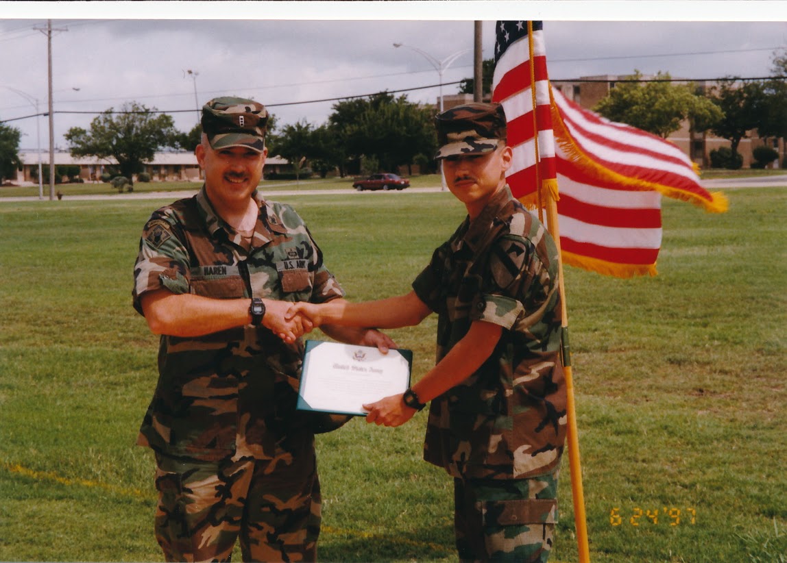
Another Soldier, SPC Cantu, reenlists for the Frost Course. In this case I was even able to wrangle him an assignment to the Topographic Engineering Center. He still owes me a beer

But I never got to take the course from Dr. Frost. I would send Soldiers at the drop of a hat but my superiors never seemed to think it important that I attend. Dr. Frost retired in 1990 but before he left he handed responsibility for teaching and updating the class over to Major John Jens, who worked at the Topographic Engineering Center (the successor to ETL) at Fort Belvoir. In 1995 I was sent to the Defense Mapping School for my Warrant Officer Advanced Course. Since only two of us showed up for the Advanced Course that year the course coordinator had little for us to do. We were supposed to work on a nebulous ‘research paper’ but that was it. I could have wandered the hallways and counted floor tiles for a month and still graduated at the top of my class. One day right after I arrived I picked up a DMS course catalog and saw that John Jens (now retired) was scheduled to teach the Frost Course the next week. I looked over at the course coordinator and said, “I’ve never been through the Frost Course. I think I’ll sit in on it.” “Sure,” he replied “sounds like a good idea.” He went back to his Washington Post crossword puzzle relieved that he wouldn’t have to babysit me for another few weeks.


A month ago I was going through some old Army paperwork and unearthed all of the Frost Course modules I worked on in John Jens’ class back in 1995. Looking through the aerial photos and study papers triggered a wave of nostalgia and caused me to write this post. But more to the point, since 1995 I’ve had literally hundreds of hours of additional education and training in terrain analysis, geospatial analysis, graduate level work in geography, geodesy and surveying and a broad range of industry specific geospatial software training. I can honestly say that nothing I’ve been taught since 1995 has approached the analytical rigor that the Frost Course demanded. It was (and hopefully still is) that good.

– Brian

Longitude

It is rare that a movie or series ends up being as good as the book it was based on; the examples are few and far between. Frankly most films just can’t capture the essence of the story the book’s author worked so hard to get across.  Maybe Gone With The Wind, but that’s about all I can think of right now.

But this weekend I was happily reacquainted with a video series that does a great job of capturing the essence of the book it was based on.  The video series is called Longitude and it’s based on the classic book Longitude written by Dava Sobel.  I consider Ms. Sobel’s book to be a staple of any geographer or topographer’s library and highly recommend it.

Ms. Sobel wrote about the half-century long efforts of a country carpenter and clock maker named John Harrison to claim the prize established by British Parliament that promised to award £20,000 to anyone who develops a practical way of determining longitude at sea. For the British this was a critical issue. The Royal Navy was losing ships and crews at an alarming rate because its sea captains and sailing masters had no way of determining longitude. The British government considered ‘finding the longitude’ to be the most critical scientific problem of its day. Without accurate navigation at sea the British empire may well have died on the vine. After all, if you can’t reliably communicate with your far-flung colonies and safely move people and cargo between the colonies and the British Isles you run the real risk of losing control of your territorial gains.

John Harrison along with his son William built and tested a series of clocks over the span of 40 years, each of which improved on the previous until he reached his final design known as the H4 (for Harrison Number 4), a small, practical chronometer that was accurate enough to permit navigation to within a half degree of longitude, well within the standards set out by Parliament. It is this particular chronometer that became the design model for nearly every mechanical marine chronometer built between 1776 and the development of GPS in the 1980s

What makes the series so good is that it has all the elements required to tell a great story – a good tale, good screenwriters who understand the subject, an excellent cast and good production values. The video series was produced in 2000, five years after Sobel’s book was first published, and the film brings the story to life.  The series was originally broadcast in the US on the A&E Channel, but is now available on DVD. The story is carried by the strong performances of Michael Gambon as John Harrison and Jeremy Irons as Rupert Gould, the shell shocked Royal Navy officer who began restoring Harrison’s chronometers during WWI. The rest of the cast is also first rate and they all seem to have really gotten their teeth into the story and the historical characters they portray.

I do have a few minor quibbles, mainly how 18th Century Royal Navy officers and ship’s masters are portrayed, but overall the video series is excellent.

Here’s a small snippet from YouTube:

Do yourself a favor and either buy or rent this great series. And remember – without the chronometer England might not have had an empire. It was that critical to British history.

– Brian

Some GNSS Musings

First things first – GNSS is the new GPS.  Actually, GPS is a subset of GNSS. GPS stands for Global Positioning System, GNSS stands for Global Navigational Satellite System. For decades folks refereed to any and all satellite navigation systems as GPS, and for good reason – the US Global Positioning Satellite system was the only game in town. However, the term ‘GPS’ properly describes just the global positioning system established and maintained by the United States. Now that the Russian GLONASS system is operational, and systems from the European Union, China and perhaps other players (India?) are coming on-line, the term for ALL space-based satellite navigation systems has shifted to GNSS.

OK, now that that’s out of the way.

I spent the last two days in training finally learning how to run Trimble’s TerraSync and Pathfinder Office software.  We’ve had TerraSync and Pathfinder Office software in our office for years, but never got any formal training on how to use either package.  The training was actually very good, and I can see now why a lot of surveying and engineering firms prefer TerraSync over GIS-centric packages like ESRI’s ArcPad.

The class was taught by one of the training and support personnel from our local vendor, NEI, and he did a great job.  Woven throughout the class are discussions about GPS, datums, coordinate systems and issues like unanticipated coordinate system shifts due to improper datum selection or datum mis-matches between the software and virtual reference station (VRS) datums.  We spent a good deal of time in the field actually experiencing the impact of changing datum selections in the software (for example, the shift seen when selecting NAD83 vs. NAD83 HARN).

So this class got me thinking again about GNSS and data quality and accuracy…

In the olden days, like before the turn of the century, these datum shifts generally didn’t concern GIS folks.  The shifts introduced by any datum mis-match were well within most folk’s error budgets.  In most cases we were ecstatic when GPS got us within a few dozen feet of the features we were collecting.  When the accuracy standard of the 1:50,000 topographic map you were using as a base was +/- 50 meters having GPS points a dozen or so feet off was no big deal.  In fact, we were tickled pink to be able to get that level of autonomous GPS accuracy.

Today things are much different. Improved GNSS software, antenna designs, the open availability of reliable GPS and GLONASS signals and the wide availability of GPS augmentation services like WAAS and local virtual reference stations (VRS) means that these systems are capable of sub-meter, often sub-foot, accuracies. That’s just for GIS data collection.  Survey-grade GNSS systems are capable of real-time accuracies to tenths of a foot. Suddenly datum shift errors of even one foot become very, very important for high precision data collection and surveying.

One of the biggest problems people in my line of work face is a general lack of understanding of GNSS in the GIS and civil engineering fields. In particular, many professionals lack up-to-date training and working knowledge of GNSS system capabilities, limitations and application to their line of work.  Evaluating and planning for the potential impact of things like datum shift on GNSS-based surveys or data collection projects is something they can’t comprehend largely because they haven’t been trained on it and, perhaps most important, have’t been forced to consider it when planning or managing a project.

Sadly, I’ve met far too many people with a GISP certificate hanging on their wall who couldn’t tell me the fundamental difference between the NAD 27 and NAD 83 datums, and I have yet to meet a single civil engineer who is not also a licensed surveyor who could explain to me the importance of knowing the datum his or her CAD drawing coordinate system is based on.  Yet both of these groups – the GIS professional and the civil engineer – have a fundamental interest in controlling the overall accuracy and precision of their work.  For the GIS professional it’s a matter reputation and trust.  For the licensed civil engineer it could be a matter of putting his or her work at legal risk.

If you work in the GIS field you can not call yourself a GIS professional unless you have a fundamental understanding of datums, coordinate systems and the importance of applying this knowledge to your workflows.  A strong knowledge of datums and coordinate systems is one of the foundational building blocks of our profession, and since so much of what we do these days is GNSS-based it makes it equally important to have a strong understanding of the impact different datum selections can have on the spatial quality of our data.

I’ve said before in this blog that those GIS ‘professionals’ who consider GIS to be little more than making web maps are headed to extinction. Here in the Atlanta metro area it would take me about an hour to hire a busload of web developers who can make web maps (and this includes time out for a stop at Starbucks). If that bus accidentally rolls into the Chattahoochee River and everybody drowns I can get another busload just as fast. However, the number of GIS professionals I’ve run into who can tell me the anticipated shift in State Plane (NAD83) and State Plane (NAD83 HARN) coordinates wouldn’t fill the first row of that bus.

For the civil engineering community the issue is less obvious but just as critical. GNSS-based surveying and data collection is becoming the norm on many projects. It is faster, cheaper and just as accurate as conventional surveys under the right conditions. This means civil engineers will be incorporating more and more GNSS-based data into their designs and relying on GNSS for jobsite control, machine control and as-built data verification. While the task of establishing project control, setting up survey equipment configurations and managing project survey requirements will fall to the the project surveyor, the project engineer still has overall responsibility for ensuring things are built to design.  If the project stakeout is a few feet out from the design drawings it may not be because the instrument operator has a hangover; it may be because the design work was done in one datum and the GNSS survey unit is set to another. Being able to identify a potential datum shift problem is a key skill for civil engineers working in today’s GNSS-based world.

– Brian

More Money Than Sense?

Last night on eBay someone plunked down $1,200.00 (plus $25 shipping) to purchase a used Brunton pocket transit. Silly impulse purchase? A case of SUI (Surfing Under the Influence)? Or does the buyer know something I don’t?

BruntonAuction1

This auction opened and closed on the same day. The opening bid price (set by the seller) was $700, with a buy-it-now price set at $1,200. I thought $700 was somewhat high, but clearly someone else thought $1,200 was just right

You see, this particular Brunton appears to sport the serial number 232 (although it’s hard to make out in the lousy photos the seller provided). If the serial number is valid this puts it somewhere in the first or second year of production – around 1895. This is by far the earliest production Brunton I’ve ever seen for sale.

bruntonAuction2

Given what information could be gleaned from the poor photos the seller provided, this transit looks right for an early model – hand engraving on the lid (with no sine tables), small view hole in the lid, no lid mounted peep sight, no tripod bracket slots and a single tube level on the clinometer

I sincerely hope the buyer is happy with his/her purchase. Who knows, perhaps it’s destined for a museum collection (which might explain why it sold so fast at the buy-it-now price). If the buyer happens to read this blog I’d love to hear more about your decision to purchase this pocket transit and perhaps provide a few detailed photos of this remarkable example to share with the readership.

I’ve added this Brunton to the Pocket Transit Serial Number Project spreadsheet so we have a record of its existence and sale. To date it is the second oldest Brunton on the list. I’d love to know more about its history – who owned it, where it was purchased, where it was used. These fine old instruments usually have a great story to tell.

– Brian


We Missed The Hedgerows

It is Memorial Day and I’m thinking about those that made the ultimate sacrifice, and what might have been done differently that could have ensured many of those we lost instead made it home safe and sound.

One of the key Engineer topographic intelligence failures of WWII took place during the planning phases of Operation Overlord, the Allied invasion of France. This was the failure to properly assess the impact the hedgerows in Normandy would have on our ground movement and tactical operations. This failure to identify and assess the impact of the hedgerows, and then develop tactics and training procedures to deal with them, resulted in the unnecessary deaths of hundreds of Allied Soldiers.

The hedgerows in Normandy were used to create small pastures and farm fields, many of them just a few acres in size. In a land without rocks or trees these hedgerows were the fences that kept cattle from wandering off and allowed farmers to clearly identify what land they owned.

Normandy Hedgerow Profile

The Normandy hedgerows were made up of linear mounds or walls of earth topped by a thick tangle of trees and brush. Most of the hedgerows dated back hundreds of years, some back to the time of William the Conqueror. Centuries of soil compaction and vegetation growth meant the hedgerows were dense, sturdy obstacles that were virtually impossible to penetrate. On a flat and otherwise featureless coastal plain the hedgerows created heavily dissected terrain with limited line of sight and restricted virtually all off-road movement.

 The hedgerows of Normandy, just in from Omaha Beach, created a tactical nightmare for the US forces that landed there on June 6th, 1944


Bocage_country_at_Cotentin_PeninsulaHedgerows in Normandy as seen in an oblique aerial reconnaissance photo taken by the US Army Air Force before the invasion. In this photo the hedgerows present obvious obstacles to movement so why didn’t they get more serious analysis?


The German Army was the master of the defensive operation. We had already seen that in Italy, where German Field Marshall Albert Kesselring established a defensive line in the mountains north of Rome (known as the Gustav Line) that turned Churchill’s ‘soft underbelly’ operation into a meatgrinder that chewed up entire Allied divisions. In Normandy the local German commanders had months to study the problem and turned the hedgerow complexes into deathtraps. Every hedgerow corner, every road and trail, every chokepoint was covered by machinegun, mortar, anti-tank and artillery fire. Normandy was a defender’s paradise, and the Germans made the most of what they had. Normandy became a textbook case of a tactical defense in-depth, and the German efforts are still studied today.

U_S_Army_in_World_War_II_Photograph_of_GIs_Moving_Cautiously_Between_Hedgerows_in_Normandy

American Soldiers cautiously working along the hedgerows in Normandy to flush out German defenders


440615 hedgerows 2

 American Soldiers standing in a narrow lane between two hedgerows somewhere in Normandy. This type of terrain became an alleyway of death for Allied Soldiers who only had two options – advance directly into the enemy fire or retreat back from it. There was no going around


The Allied armies never really defeated the hedgerow problem. The advance through Normandy became a slow slog with infantrymen fighting for every foot of terrain. The US Army eventually developed a set of combined arms tactics using dismounted infantry and tanks that allowed effective movement, but in the end it was commanders like General Patton who simply decided to punch through the hedgerow country and break out into the more open terrain south of Paris. In the end the Allies simply bypassed the German defenders in the hedgerows and left them to wither on the vine. Most surrendered within a few weeks, out of food, out of ammunition and out of the will to continue the fight.

But the question remains – how did we miss the impact the hedgerows would have on our tactical operations? We didn’t lack for topographic intelligence analysis during the planning phases for Overlord. The beaches and inland areas of Normandy received some of the most intensive Engineer terrain and intelligence analysis ever applied to a piece of ground. We collected tens of thousands of aerial photos (many of them in stereo), built hundreds of terrain models and printed thousands of special maps and geographic (terrain) studies of the Normandy region. Small unit commanders had the best picture of their objectives, and the terrain leading up to their objectives, than had ever been developed for any military operation up to that time – and yet we missed the hedgerows!

There’s no definitive answer in the historical record as to why the Normandy hedgerows were not identified as significant obstacles, but I can make a few good educated guesses as to what happened.

First, there is this intriguing passage from Chapter 13, Looking Ahead To The Continent from the volume ‘The Corps of Engineers: The War Against Germany’, part of the US Army’s official history of WWII (the excellent ‘Green Book’ series):

Hedgerow Statement

The large scale topographic map is the standard military planning document. Planners at all levels – from Infantry platoon all the way up to Theater Army G-3 – rely on the topographic map to provide an accurate representation of the ground they are going to fight over. The general assumption is that if it’s not on the map it is either not there on the ground, or it’s not important enough to worry about from a military operations perspective. Yes, the map is just a base to build on, but Soldiers are trained from day one to trust what they see on the map to be an accurate representation of what they will find on the ground. If hedgerows are missing from the map, even though they may be visible in aerial photography, the assumption is that someone further up the chain with more smarts and access to better data took a hard look at the hedgerow problem and decided it wasn’t anything to worry about. This seems to have generated a false sense of security regarding the hedgerow issue that permeated all levels of Allied command.

Additionally, in the same chapter Major General Cecil Moore, the Chief Engineer of the European Theater of Operations, admitted that his Engineer staff was inadequate to the task of providing all the topographic intelligence needed to support the invasion planning. Topographic intelligence was new ground to many Engineer officers and they lacked the education, training and experience necessary to provide the support needed. This is a remarkable admission considering all the other excellent Engineer analysis that took place prior to the invasion. My guess is that Moore’s staff focused tightly on analysis of the invasion beaches, exits from the beaches and the avenues of approach to the initial objectives, and German obstacle emplacements that were visible in aerial photos. There were river crossing operations, road repairs and improvements, airfield construction, port repairs and a whole host of other critical Engineer tasks to focus on. Hedgerows, if anyone on Moore’s staff thought about them at all, were probably considered a minor issue in the overall scheme of things.

There are three other issues that I’m sure probably came into play – wishful thinking, complacency and ‘go fever’.

Wishful thinking. Having served on Army planning staffs from brigade all the way up to theater army level I can assure you that there’s a lot of wishful thinking that goes on during the staff planning process. While we train our planners to not allow wishful thinking to creep into the planning process, many times tough problems that are just ‘wished away’ on the assumption that someone else will solve it or it will resolve itself before the operation gets underway. I’ve seen this dozens of times, like when I told a tank battalion commander that his 12 foot wide Abrams tanks won’t fit down that 10 foot wide trail in North Korea that he was planning to use. He waved his hand dismissively and told me that if and when the time comes he’d find a way around the problem.

Complacency. American Soldiers had been training in England for months before the invasion, and hedgerows are a common feature of the English countryside. But the hedgerows of England are were far smaller and easier to move through or over. Most could be simply hopped over. I’m sure many unit commanders looked at the aerial photos of Normandy and based on their experiences in England didn’t think the Normandy hedgerows would be much different. After all, a hedgerow is a hedgerow, right?

‘Go fever’ is the feeling that nothing is going to be allowed to stop the show. I’m sure ‘go fever’ saturated the Allied planning staff as June 6th approached. Nobody was going to try to halt the invasion for any reason; it was going to go as scheduled regardless of any last minute issues that might pop up. When an entire Army has ‘go fever’ nothing seemingly as minor as hedgerows will stop the largest invasion in history.

It took decades for the Army Corps of Engineers to recognize that topographic intelligence analysis was a critical skill that needed formalized processes and uniquely trained Soldiers. It was actually the Army Intelligence community’s efforts in the late 1970’s to formalize the Intelligence Preparation of the Battlefield (IPB) process that spurred the Engineers to action. IPB as an analysis process is heavily dependent on weather and topographic (terrain) analysis. The Intelligence community was set to establish their own organic terrain analysis assets when the Director of the Army’s Engineer Topographic Laboratory warned the Chief of Engineers that if he didn’t get serious about Engineers doing topographic analysis a key and historic Engineer responsibility would be ceded to the Intelligence field. Soon after the Corps of Engineers established the Terrain Analysis field and seeded Terrain Analysis units across the Army division, corps and theater army force structure.

Today Terrain Analysis is known as Geospatial Analysis and it’s the last vestige of the old Army topographic field left in the Army’s force structure. Since 1980 the Army’s Terrain/Geospatial Analysts have been doing the type of detailed analysis that might just have identified the hedgerows in Normandy as a serious obstacle. Our analyst are trained specifically to look at the small stuff – the trails, the fencelines, the stands of trees, even the hedgerows that might pose a problem for even the smallest of military units.

On this Memorial Day I’m praying we never have another ‘hedgerow problem’ on any battlefield American Soldiers are deployed to.

– Brian


Columbus – Explorer, Cartographer, Naturalist

…eh? Naturalist?!

This week I was visiting family in Philadelphia and being the history nut that I am I decided to take a day to see the sights. Unfortunately the Independence Mall area was flooded with kids on end-of-year class trips so I avoided that part of town. Luckily (for me) the Independence Seaport Museum area was virtually empty. Deserted is a better term. While I’m concerned about the lack of attention this great Philly museum complex gets, for guys like me who like their museum experiences sans hyperactive grade schoolers it was a great day to visit the place.

The Independence Seaport Museum celebrates Philadelphia’s history as a major seaport. From the city’s founding in 1682 right up through WWII the city was one of America’s major seaports, and at times handily out ranked New York and Boston as the #1 seaport in the nation.

The city has also had a large Italian population, and South Philly has long been known as a center of Italian-American culture.  I believe it was the Italians in Philly that gave us one of the greatest culinary masterpieces of all time – the Philly cheesesteak sandwich (made, as God intended, with provolone cheese, not that hideous Cheese-Whiz that’s become so popular).

In 1992 the Italian community in Philadelphia decided to celebrate their heritage and the 500th anniversary of the discovery of the Americas by honoring a favorite Son of Italy, Christoper Columbus. Just ignore the fact that Columbus wasn’t Italian, he was Genoese; Italy as a nation didn’t exist until the late 19th century and Columbus would have never considered himself Italian. In fact if you called him Italian to his face he probably would have had no idea what you were referring to. Or he’d have taken it as an insult.

As part of the celebration the Italian community had a memorial erected on the grounds of the Independence Seaport Museum commemorating Columbus and his achievements. The memorial is an impressive three-sided tower, the base of which is sheathed in granite plaques that list Columbus’ achievements along with the list of prominent contributors to the memorial.  The list of contributors looks like it was taken straight out of a phone book from southern Italy, with one key exception – a guy by the name of Ed Rendell. But hey it’s Philly, where anyone can be made an honorary Italian.

The list of Columbus’ achievements looks good. Christoper Columbus the Charismatic Leader and Navigator.

IMG_3775

Christoper Columbus the Mathematician and Cartographer:

IMG_3777

Christopher Columbus the Explorer, the Visionary, the… Naturalist?!

IMG_3778OK, I’m a big fan of Columbus and I pretty much agree he was a great visionary, explorer, cartographer, mathematician and leader, but it’s a real stretch to label him a naturalist.

Sure Columbus dragged a few plants back to Spain with him to show off to Their Catholic Majesties, Ferdinand and Isabella. But trust me, he was only bringing back plants he thought he could make a buck off of.

If Christoper Columbus was a naturalist then I’m Frank Sinatra.

– Brian

Topographic Instructions of the US Geological Survey

How do you make a map? More precisely, how does one produce a map compiled to specific standards for accuracy, content and style? Does that question keep you up at night? Nah, me either. But it is an interesting question and I’d bet that if you put it to 100 people you’d get 110 answers.

Of course today it’s easy. Nobody really makes a map these days. Most just go to Google Maps on their smartphone or tablet, and these days that’s about all the ‘map’ most people want or need.

But 100 years ago things were much different. Back then there were still vast unmapped areas of the US and it was the responsibility of the US Geological Survey (USGS) to send topographic parties in to map them. This was before the era of cell phones, internet, GPS and even radio communications. Checking with the home office involved the US Mail or, if they were lucky, telegraph. For that reason these parties operated autonomously under the direction of a Party Chief. The Party Chief was part military general, part football coach and part college professor; he ruled with an iron fist and made sure everything was run properly, was responsible for the motivation and morale of his party and was the brains of the outfit. The Party Chief was vested with enormous authority because he had an enormous responsibility – he answered to his regional Chief Geographer for the accuracy and quality of his party’s work.

In 1913 Party Chiefs didn’t go about their work blind. They operated under a very detailed set of instructions and standards laid out in a USGS publication titled Topographic Instructions of the United States Geological Survey.

Topographic Instructions of the USGS

I find this a fascinating manual because it is the only publication I’ve seen that lays out in detail the steps necessary to create a map from scratch. It covers all the processes involved in creating a map to very specific accuracy, content and composition standards. This is, quite literally, the document that defined what we know today as the standard USGS topo quad sheet. Of course the USGS was producing standard topo sheets before this manual was published, but indications are that prior to 1912 the instructions were covered in separate publications and broken out by discipline. This manual brought it all together in a single reference that is remarkably clear and concise for its time, stripped of a lot of the superfluous language that Edwardian-era government functionaries were so fond of using. This is a manual designed to be used in the field by men who have a job to do.

The topics covered include

  • primary and secondary triangulation
  • primary and precise leveling
  • plane table surveying
  • map construction (compilation), drafting and editing
  • instrument care and repair

But beyond the technical, Topographic Instructions of the United States Geological Survey covers detailed administrative instructions to Party Chiefs on topics like crew selection, first aid for pack animals and crew members, how much food to pack, how many fountain pens to bring along, how to set up a base camp, even how to interact with local officials and the press.

It’s a soup-to-nuts manual on how to make a map from scratch.

– Brian

Christopher Columbus

Word came out earlier this week that marine explorer Barry Clifford has located the shipwreck of the Santa Maria, the vessel Christopher Columbus used as his flagship on his first voyage to the New World in 1492. If Clifford’s claim pans out, this would be the oldest and most historically significant wreck of a European ship in American waters.

The circumstances of the wreck were actually well documented by Columbus in his journal. The Santa Maria apparently died a slow death. Battered and leaky after months at sea with little maintenance, the ship broke her moorings and ran aground on a shallow reef outside Cap Hatien off the north coast of Haiti just after Christmas, 1492.

hispaniola_custom-34e1421a6c894c47ab2433af33a98d08d2af7f83-s40-c85

Excerpt from Columbus’ journal detailing the location of the wreck of the Santa Maria. The general location of the wreck site was always known, but the exact wreck wasn’t identified until 2003

The Santa Maria went down in only 10 feet of water so Columbus ordered the ship to be stripped of her fittings and timbers removed for use on land. All that remains today is the ship’s ballast field and perhaps some fittings that weren’t salvaged. The wreck was apparently identified by the remains of a wooden cannon mount, a type that would have been unique to the Santa Maria.

santa_maria_vray24

A modern recreation of Columbus’ Santa Maria

This discovery causes me to think again about Columbus’ place in the pantheon of explorers and navigators. Columbus’ reputation has suffered mightily in the last 50 years or so. He’s gone from a revered European explorer with his own national holiday and dozens of American towns and cities named after him to the despised symbol of all that was bad about European colonization and exploitation of the New World.

Revisionist history can be a dangerous practice, and I believe Columbus has been treated badly by those who blame him for everything from smallpox to global warming. Columbus was very much a man of his time – he was no more exploitative, cruel or greedy than any other late-15th century explorer and navigator. One thing we know for sure, if Columbus didn’t set sail for the ‘Indies’ in 1492 another European explorer would have tried it soon after. European merchants were being squeezed out of the extremely lucrative trade with the Far East empires by pirates, local warlords and caliphs who controlled the sea lanes and trading ports between eastern Africa and the Far East.

Columbus’ sales pitch to King Ferdinand and Queen Isabella made perfect sense; the world is round (everybody in the 15th century who could read understood that) and the latitudes of the key trading ports in the Far East were well known. All one has to do is sail straight west from Spain along a known latitude and eventually you’ll run smack into the the trading ports in the West Indies. None of that messy sailing around the Horn of Africa business or fighting off pirates or paying off local warlords. It was an enticing argument – sail west, hit the trading ports in the Indies, load up with highly profitable trade goods and sail back east to the home country to unload, sell and enjoy immense profits. I have no doubt that in 1492 other European explorers and traders were thinking the exact same thing. It was simply the next logical step in establishing trade routes in search of new markets. If not Columbus another European with the same outlook and values would have made the voyage, made landfall in the New World and set in motion the exact same chain of events that led us to where we are today. It was a historic inevitability. Let’s stop blaming Columbus.

We know very little about Christoper Columbus’ early life, and it appears that’s the way he wanted it. He was born in Genoa in 1451 to a family that engaged in a broad variety of commercial endeavors. He went to sea early in life, starting as a deck hand on the small sailing ships that moved trade goods between the major Mediterranean ports. But Columbus was smart and fairly well educated for his time. He was also a keen observer and a quick study. At one point he got into the map making business, which put him in touch with most of the experienced explorers and navigators of his time. He also participated in longer and longer sea voyages as the Portuguese and other European traders probed further and further south and west into the Atlantic, discovering the scattered island chains like the Azores, the Madeiras and the Canary Islands.  Along the way Columbus became an expert navigator. Perhaps just as important, his extended sea voyages west into the Atlantic convinced him that existing sailing and navigation technology could make long ocean voyages westward to the Indies not just possible, but practical. Unlike so many sailors of his day Columbus was not afraid to sail well out of sight of land. He was a confident and competent navigator, one of the best of his time.

800px-ColombusMap

A map (more commonly known as a ‘portolan chart’) published by Christopher Columbus and his brother Bartolomeo in their Lisbon workshop, 1490

Columbus was also a businessman and a bit of a hustler. He knew he needed financial backing for his plan and he spent years peddling his idea around the courts of Europe. Monarchs of his day weren’t dumb. Those that had any interest in his scheme turned the proposal over to the more learned men of their court for review and recommendation. In virtually every case Columbus was turned down not because his idea was bad (many court scholars agreed the general idea had merit), but because Columbus badly under estimated the circumference of the earth. In his proposals Columbus stated the circumference of the earth was several thousand miles smaller than it actually is. The problem for Columbus was that in the 15th century the general circumference of the earth was well know. In fact, it was first accurately measured by the Greek mathematician Eratosthenes about 190 B.C. All the smart guys in Europe knew this. Everyone except Columbus, it seems. Or was his ignorance really a marketing ploy? Columbus knew he had to sell his idea as a practical, repeatable way to make money. By understating the sailing distance from European ports to the West Indies he was implying reduced risk, lower operating costs and greater profits.

Like the monarchs Columbus pitched his idea to, he wasn’t dumb. I’m betting he clearly understood just how big the Earth is. My guess is that based on his experience sailing to the island chains off the west coast of Europe and Africa he was expecting to find mid-ocean islands he could use to rest and refit as necessary. But this is just my speculation. We’ll probably never know Columbus’ true thoughts or motivations.

Of course we all know that Columbus eventually found his patrons, got his ships and crews, sailed west and inevitably bumped into the ‘Indies’. The rest, as they say, is history – our history.

Christoper Columbus deserves better press than he gets today. The European discovery and settlement of the New World was inevitable. If not Columbus then someone else very soon after 1492. So let’s celebrate Columbus the explorer, map maker and master navigator.

– Brian